Transportation
3
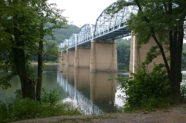
Point of Rocks has long been a distinguishing natural feature for Native Americans residing in and traveling through the region. Until the Treaty of Albany in 1722 involving English state representatives and the Iroquois Nations, the area was nominally controlled by the Iroquois Confederacy. Paleo-Indians first arrived here about 10,000 BC. After the Colony of Maryland was founded in 1632 by the Second Lord Baltimore under a grant from King Charles I, the area was mapped in 1707 by Swiss explorer Louis Michel, and in the 1720s many settlers arrived, moving south and west along the Potomac. A Potomac ferry service was established in 1735 and operated under various owners until a bridge completed in 1852 made it obsolete. Greg Snouffer built the first tavern in Point of Rocks in 1825. From 1828 to 1832, the C&O Canal Company and the B&O Railroad fought a legal dispute over right of way through the narrow pass at Point of Rocks; the B&O reached Point of Rocks from Baltimore in 1832, a compromise was reached in 1833, and a notable rock spur was blasted so both could pass. The C&O Canal opened service from Washington, DC through Point of Rocks in 1834, and the town was incorporated in 1848. The first wooden bridge across the Potomac at Point of Rocks opened in 1852 and accommodated rail traffic, carriages, and horses. During the Civil War from 1861 to 1865, Point of Rocks became a hub of conflict because of its bridge, railroad, canal, and proximity to Virginia, and the bridge was destroyed in 1861. The B&O Railroad blasted a tunnel through Point of Rocks in 1868 and in 1873 connected it to Washington, DC via the Metropolitan Branch. The Point of Rocks train station was built in 1876 and still stands at the railroad junction. Numerous major floods occurred before modern record keeping, and recorded major floods repeatedly shaped the community, including severe floods in 1889, 1924, 1936, 1937, 1942, 1955, 1972, 1985, and twice in 1996. An 1889 flood washed away a new bridge on the day it opened and severely damaged the C&O Canal. A new Pratt Truss steel bridge opened across the Potomac in 1892. Electricity arrived in 1920 and 1921. In 1924, major flood damage, lack of investment, and railroad competition ended the C&O Canal's commercial use. In 1937, the Potomac bridge was rebuilt in its current Camelback Truss form with WPA funds. U.S. 15 was completed from Point of Rocks to Frederick and beyond in 1939. During 1941 to 1945, Point of Rocks saw substantial war-related expansion in railroad use, including troop and supply movements. Around 1968, the first major subdivision, Point of Rocks Estates, opened. In 1970, a new U.S. 15 alignment opened from the bridge to the new Route 340 interchange, and 22 homes were removed, including all those overlooking the town on Catoctin Ridge. In 1983, MARC was established. In 1987, B&O and CSX were incorporated. In 1999, FEMA and MEMA bought out about 24 residential structures in the Potomac floodplain, and all were demolished by 2007, including many on this site. The population was 150 in 1887, 500 in 1934, 369 in 1940, 300 in 1972, and 1,466 in 2010.
Hear stories like this as you drive
ExploreHere reads historical markers out loud as you pass them: over 325,000 stories across the US. No account needed.
4.7 · 800+ ratings · Free
FIND IT
Point of Rocks, Maryland · United States