History
6
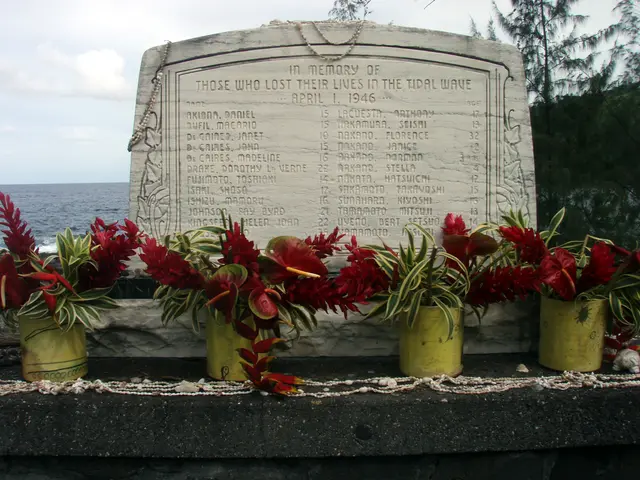
Laupahoehoe Point changed from a peaceful Hawaiian fishing village, where the valley and sea provided abundant life, into a sugar plantation harbor and thriving town. In the late 1800s, one of the island's sugar plantations was located there, and Laupahoehoe became one of four deep harbor ports besides Hilo, where ships moored to transport goods and unload tourists, cattle, sugar, and other merchandise. Laupahoehoe town stood in the valley along the old Mamalahoa Highway and included restaurants, hotels, a coffee mill, soda works, livery stables, and a post office. In the 1920s the village population grew to about 2,000. From 1912, rail travelers stopped at the Laupahoehoe station and went down to the Point on foot or by horse, but as train travel increased, activity in the valley town declined and merchants gradually moved their businesses to the mauka area now known as Laupahoehoe. In 1946, a tsunami generated by an earthquake in the Aleutian Islands struck Hawaii, ended coastal rail services, destroyed much of Hilo, and killed more than 150 people. Laupahoehoe lost 24 residents to the waves, many of them students and teachers, and many private homes were demolished, leading to the decision to move the school to higher ground even though the school buildings were not destroyed. Through its history as a port of call, a small community, and the site of the tragedy of 1946, the point has remained one of Hawaii's most ruggedly picturesque areas.
Hear stories like this as you drive
ExploreHere reads historical markers out loud as you pass them: over 325,000 stories across the US. No account needed.
4.7 · 800+ ratings · Free
FIND IT
Laupahoehoe, Hawaii · United States