History
8
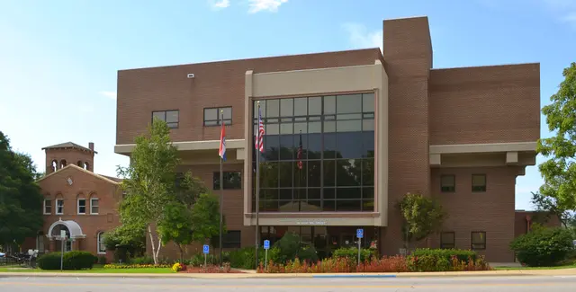
In Missouri's central Ozarks, Pulaski County was organized in 1833 and named for Revolutionary War general and Polish Count Casimir Pulaski. Once roamed by Indians and French trappers, it formed part of land ceded by the Osage in 1808. Southern pioneers were early settlers, drawn by fine springs, wooded hills honeycombed by caves, and the Big Piney and Gasconade Rivers. Waynesville, in the scenic Roubidoux Creek Valley, became the county seat in 1843, though court first met there in 1835. Named for Revolutionary War General "Mad" Anthony Wayne, the town stood on the Saint Louis to Springfield Road, also called the Wire Road after a telegraph line was strung along it by the Union Army; French explorer Du Tisne had traveled this former Indian trail in 1719, and Cherokee Indians camped there during their 1837 Trail of Tears removal to Okla. In the Civil War, the Confederate flag was raised at the courthouse in the spring of 1861, and in June 1862 Union Colonel Albert Sigel's troops built a fort overlooking Waynesville's courthouse square to guard the military supply road to Springfield, while the county suffered guerrilla raids and skirmishes. After the Civil War, Pulaski County grew as a lumbering and general farming area. The Frisco R.R., built through the county in 1869, brought the laying out of Dixon, Crocker, and Richland, while Swedeborg was founded by Swedish immigrants in 1878. Within the county's Mark Twain National Forest acreage, established in 1935, Fort Leonard Wood was founded in 1940 as a World War Two training and replacement center, became a permanent military reservation in 1958, and by 1960 was the nation's largest center for training U.S. Army Engineers. Other communities include Big Piney, Devils Elbow, Laguey, Palace, and Saint Roberts, and points of interest include views of the Gasconade at Portuguese Point and the Big Piney at Devils Elbow, Miller Spring near Big Piney, Schlicht Mill near Crocker, Indian and Inca caves near Waynesville, Moccasin Bend Wildlife Refuge on the Gasconade River, Waynesville's fourth courthouse built in 1904, and many prehistoric artifacts found in the county.
Hear stories like this as you drive
ExploreHere reads historical markers out loud as you pass them: over 325,000 stories across the US. No account needed.
4.7 · 800+ ratings · Free
FIND IT
Waynesville, Missouri · United States